


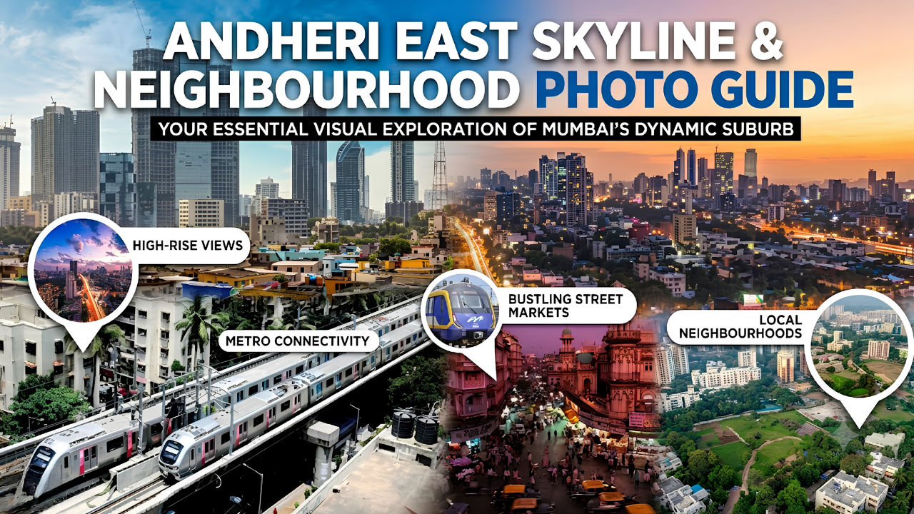
Andheri East Skyline and Neighbourhood Photo Guide
Dasadia Editorial Team · Updated August 2026
The 30-Second Answer
Andheri East photographs as three layers stacked on top of each other: a corporate skyline of glass towers along Andheri-Kurla Road, an infrastructure layer of elevated metro viaducts and highway flyovers, and beneath both, a village layer of gaothans, 2,000-year-old Buddhist caves and a ruined 16th-century church. Almost all of it is shootable on foot with a phone. One thing is not negotiable: you cannot legally fly a drone here — the entire suburb sits inside the airport no-fly radius.
Source: Mumbai Wiki · Wikipedia · MavDrones
Executive Summary — Key Takeaways
- Drones are prohibited within 5 km of the Mumbai airport perimeter, which covers effectively all of Andheri East.
- Mumbai Police also issue rolling 30-day prohibitory orders banning drones and similar aircraft across the city.
- Mahakali Caves — 19 rock-cut Buddhist monuments in basalt — are open 09:00 to 17:00 with an entry fee of about ₹20.
- Photography is permitted inside the caves; flash is prohibited to protect the carvings.
- The ruined St John the Baptist Church of 1579 sits inside the SEEPZ zone and opens only once or twice a year.
- Marol Gaothan is a notified village settlement of narrow lanes, crosses and low-rise houses inside the modern suburb.
- The best skyline vantage points are the Metro Line 1 platforms and viaduct-side roads, not the highway itself.
- Golden hour here runs against the towers from the west, so evening light is generally better than morning.
Source: MavDrones · Deccan Herald · Audiala · Yappe · Free Press Journal
Before You Shoot: What the Rules Actually Say
This section comes first because getting it wrong here is expensive. Andheri East wraps around Chhatrapati Shivaji Maharaj International Airport, and India’s drone framework prohibits flying within five kilometres of the perimeter of major airports including Mumbai. In practice that radius swallows the whole suburb — Chakala, J.B. Nagar, Marol, MIDC, Sakinaka, Sahar. There is no pocket of Andheri East where a recreational drone flight is lawful without specific written clearance.
On top of the central rules, Mumbai Police periodically issue prohibitory orders under Section 144 banning drones, remote-controlled microlight aircraft, paragliders and hot air balloons across the city for 30-day stretches, typically renewed. Flying without authorisation under the Aircraft Act can attract fines running from ₹50,000 into the lakhs, and equipment is routinely confiscated near airports. If you genuinely need aerial footage, the route is a written application to the Deputy Commissioner of Police (Operations) alongside Digital Sky registration — not a quick launch from a terrace.
Ground-level photography is a different matter and largely unrestricted. Streets, markets, metro exteriors and skylines are fair game. Use ordinary judgement: do not photograph inside airport security zones, do not shoot into private homes in the gaothans, and ask before photographing people in residential lanes. At Mahakali Caves cameras and video are permitted, but flash is prohibited because the basalt carvings are already badly weathered.
Source: MavDrones · Zbotic · Deccan Herald · Mumbai Police · Audiala
The Shot List
Times are indicative for the dry season. During the monsoon, reflections after rain make the same locations work at almost any hour, and the light is softer all day.
Source: MMRDA · Audiala · Mumbai Wiki
The Skyline: Where to Actually See It

The corporate corridor along Andheri-Kurla Road, framed from the metro viaduct.
Andheri East does not have a single postcard viewpoint, and photographers arriving expecting one leave disappointed. What it has is a linear skyline — a run of business parks and glass towers strung along Andheri-Kurla Road between Chakala and Sakinaka, with the Metro Line 1 viaduct threading through at first-floor height.
The viaduct is the key. Standing at street level, the towers are foreshortened and cluttered with hoardings and cables. From a metro platform at Chakala or Marol Naka, you gain roughly eight to ten metres of elevation and a clean line down the corridor, with the track itself providing a strong leading line. Evening is better than morning here because the sun sets to the west, behind the railway line, and rakes across the eastern faces of the towers. For traffic trails, the flyovers on the Western Express Highway offer the longest uninterrupted sightlines, and the blue hour immediately after sunset gives you sky detail and headlights at the same exposure.
The Village Layer: Marol Gaothan
Marol Gaothan — low-rise houses and narrow lanes inside a high-rise suburb.
Walk four hundred metres off Andheri-Kurla Road and the scale collapses. Marol Gaothan is a notified and demarcated village settlement whose lanes, wayside crosses and independent houses belong to a built form that predates everything around it. This is Mumbai’s East Indian Christian heritage — a community with Marathi and Portuguese cultural traces that has held its ground through decades of redevelopment on all sides.
The gaothan’s status is contested in practical terms. In 2025 residents of Bhandarwada, part of Marol Gaothan, protested against notices from the municipal corporation and the Slum Rehabilitation Authority that classified heritage homes as slums, following similar disputes at Bamanwada and Kurla Christian Village. Photograph it with that context in mind: these are people’s homes, not a heritage set. Shoot the lanes, the crosses and the rooflines, ask before photographing residents, and go on a weekday morning when the light is soft and the lanes are quiet.
Source: Free Press Journal · Mumbai Wiki · East Indians of Bombay
Mahakali Caves: The Oldest Thing in Andheri
The Mahakali or Kondivite Caves — 19 rock-cut monuments carved from basalt.
The Mahakali Caves, also called the Kondivite Caves after the neighbouring village, are a group of 19 rock-cut monuments carved from solid basalt between roughly the 1st century BCE and the 6th century CE. The complex splits into two groups — four caves to the north-west and fifteen to the south-east — with twenty entrances in total. Most are viharas, the living cells of monks; Cave 9 in the south-eastern group is the chaitya, or prayer hall, and holds the surviving stupa and Buddha figures. The site sits at about 70 metres elevation and is protected by the Archaeological Survey of India.
For a photographer this is the most rewarding hour in Andheri East. The site is small, quiet and rarely crowded, open from 09:00 to 17:00 with an entry fee of around ₹20. Morning light angles into the south-eastern group and gives the basalt texture. Flash is prohibited, so bring a fast lens or steady your phone against the rock — the carvings are heavily weathered and mutilated, and the ASI has added cement supports, so shoot for texture and form rather than detail. The nearest metro is Marol Naka. Do note the connection: the suburb’s name derives from Udayanagari, the hill beside these caves.
Source: Wikipedia · Holidify · Audiala · YoMetro · Optima Travels · Mumbai Wiki
The Ruin Inside SEEPZ: St John the Baptist Church
The single most photogenic structure in Andheri East is also the hardest to reach. St John the Baptist Church at Condita was built in 1579 by the Portuguese Jesuit Fr Manuel Gomes, making it among the oldest church structures in the city. A Jesuit report of 1669 records the parish as covering 1,380 Catholics in Marol, 302 in Condita, 246 in Gundavali and 219 in Chakala — a useful measure of how this landscape was populated four centuries ago.
The church was abandoned in 1840 after an epidemic, and its altars, carved stone pillars and baptismal font were moved to the new church built that year at Marol, which stands today as St John the Evangelist. The original was left to vegetation and ruin. Its site now falls inside the SEEPZ special economic zone, and access is granted roughly once or twice a year. If you want the shot, the practical route is to follow the parish calendar at Marol and go on the open day. It is worth the wait — a Portuguese-era ruin with its graveyard, standing inside an electronics export zone, is an image that explains Andheri East better than any skyline.
Source: St John the Evangelist, Marol · East Indians of Bombay · Wikipedia · Yappe
The Infrastructure Layer
The Line 1 viaduct above Andheri-Kurla Road — the strongest repeating geometry in the suburb.
If you shoot architecture or transport, this is Andheri East’s real subject. Metro Line 1 runs elevated the length of Andheri-Kurla Road, and its piers, curves and station canopies give you repeating geometry that the disorderly streetscape below does not. Aqua Line 3 offers nothing above ground — it is fully underground here — but the Marol Naka interchange complex is worth photographing as a piece of civil engineering where the two levels meet.
Add the highway flyovers, the Sahar elevated road towards the terminals, and the hotel cluster along Sahar Road, and you have a coherent visual essay about a suburb built for movement. Shoot it after dark: lit facades, sodium and LED street lighting, and long exposures on the flyovers turn what is a frustrating commute by day into the most photogenic thing here by night.
When to Shoot
One practical warning that applies year-round: low-lying pockets of Andheri East flood during heavy monsoon rain, and Andheri Subway closes outright. Plan wet-season shoots around the forecast, keep gear sealed, and do not treat waterlogged streets as a photo opportunity worth wading into.
Source: Mumbai Wiki · MMRDA
Kit and Etiquette
- A phone is enough for most of this — the subjects are wide, not distant.
- A fast lens or steady support matters at the caves, where flash is banned.
- Carry a small tripod for flyover light trails and blue-hour skyline work.
- Ask before photographing residents in the gaothan lanes or at Sakinaka.
- Avoid pointing cameras into airport security areas or SEEPZ gate points.
- Leave the drone at home — the whole suburb is inside the airport no-fly radius.
- Carry cash for the caves entry fee and keep the ticket for re-entry.
- Weekday mornings are quietest; weekends bring traffic and crowds to every location.
Source: Audiala · MavDrones · Free Press Journal
Fact-Check Section
- Drone flying is prohibited within 5 km of the perimeter of Mumbai airport — MavDrones summary of DGCA no-fly zones.
- Mumbai Police issue 30-day prohibitory orders banning drones, microlight aircraft and paragliders across the city — Deccan Herald.
- Unauthorised drone operation under the Aircraft Act can attract fines from ₹50,000 upwards, with confiscation near airports — industry guidance.
- Mahakali Caves comprise 19 rock-cut monuments in basalt, four to the north-west and fifteen to the south-east, with 20 entrances — Wikipedia.
- Cave 9 of the south-eastern group is the chaitya and contains the stupa and Buddha figures — Wikipedia and Holidify.
- Caves open 09:00 to 17:00; entry about ₹20; cameras permitted, flash prohibited — Audiala and YoMetro.
- St John the Baptist Church at Condita was built in 1579 by Fr Manuel Gomes and abandoned in 1840 after an epidemic — St John the Evangelist parish history and Wikipedia.
- The 1669 Jesuit report recorded 1,380 Catholics in Marol, 302 in Condita, 246 in Gundavali and 219 in Chakala — East Indians of Bombay.
- Marol Gaothan is officially notified and demarcated; Bhandarwada residents contested slum-classification notices in 2025 — Free Press Journal.
- The name Andheri derives from Udayanagari, a hill beside the Mahakali caves — Mumbai Wiki.
Source: MavDrones · Deccan Herald · Wikipedia · Audiala · St John the Evangelist, Marol · Free Press Journal · Mumbai Wiki
Frequently Asked Questions
No. The entire suburb falls within five kilometres of the Mumbai airport perimeter, where drone flying is prohibited. Mumbai Police also issue rolling citywide prohibitory orders. Aerial work requires written clearance and Digital Sky registration.
Under the Aircraft Act, unauthorised operation can attract fines starting around ₹50,000 and rising substantially, and drones are routinely confiscated near airports with an FIR registered.
From the Metro Line 1 platforms at Chakala or Marol Naka, which give you elevation above the clutter and a clean line down the Andheri-Kurla Road corridor. Evening light is better than morning.
Yes, cameras and video are permitted. Flash is prohibited to protect the weathered basalt carvings.
Generally 09:00 to 17:00, with an entry fee of around ₹20 per person. Mornings are quieter and the light angles better into the main group.
The 19 rock-cut monuments were carved between roughly the 1st century BCE and the 6th century CE, with the south-eastern group older than the north-western one.
Only rarely. St John the Baptist Church of 1579 sits inside the SEEPZ zone and opens roughly once or twice a year. Follow the St John the Evangelist parish calendar at Marol for the open day.
Yes, but treat it as a residential neighbourhood rather than a heritage attraction. Photograph lanes, crosses and rooflines freely; ask permission before photographing people or into homes.
A traditional village settlement area, predating the modern suburb, with narrow lanes, older independent houses and community structures. Andheri East’s gaothans include Marol, Chakala, Sahar, Gundavali and Saki Naka.
October. Post-monsoon clarity, green cover and moderate temperatures give the widest range of usable conditions. November to February is also reliable for skyline work.
No. Ordinary street and architectural photography at ground level is unrestricted. Avoid airport security zones and SEEPZ gate points, and use judgement around private property.
Casual photography from platforms is generally tolerated, but station staff may object to tripods or extended shoots. Keep it brief, stay clear of passenger flow, and follow any instruction from staff.
Mahakali Caves in the morning, or the Andheri-Kurla Road corridor from a metro platform at sunset. Those two give you the oldest and newest layers of the suburb in a single frame each.
Conclusion and Next Steps
Andheri East rewards photographers who look for layers rather than a single view. In under three kilometres you can move from a 2,000-year-old Buddhist rock-cut monastery to a village settlement of narrow lanes and wayside crosses to a corridor of glass towers with a metro running through it at first-floor height. Very few Mumbai suburbs compress that much time into that little ground.
Plan around two constraints and the rest follows: the drone ban, which is absolute here, and the light, which favours evenings for the skyline and mornings for the caves and gaothans. Verify the caves’ timings and the parish open-day calendar before you travel, since both change, and keep your monsoon shoots on the right side of the forecast.
Sources and References
- Mumbai Police — application for permission to fly a drone
- MahaRERA — Maharashtra Real Estate Regulatory Authority
- MMRDA — Metro Line 1 project overview
- MMRC — Mumbai Metro Rail Corporation (Aqua Line 3)
- Wikipedia — Mahakali Caves
- Wikipedia — St John the Baptist Church, Mumbai
- St John the Evangelist, Marol — parish history
- East Indians of Bombay — John the Baptist Church, Marol 1579
- Free Press Journal — Marol Gaothan heritage classification dispute
- Mumbai Wiki — Andheri gaothans, history and etymology
- Holidify — Mahakali Caves architecture and layout
- Audiala — Mahakali Caves timings, entry and photography rules
- YoMetro — Mahakali Caves access and nearest metro
- Optima Travels — Kondivite Caves history and conservation
- Yappe — St John the Baptist Church access and location
- MavDrones — no-drone zones and airport restrictions
- Deccan Herald — Mumbai Police prohibitory order on drones
- Zbotic — drone legal zones and no-fly areas in India
Disclaimer: This article is informational only. Site timings, entry fees, access arrangements and drone regulations change frequently — verify current rules with the relevant authority before travelling or flying.
Looking for a home in Andheri East?
Explore 153 East by Dasadia Developers LLP — a freehold residential address in J.B. Nagar, Andheri East, close to Chakala and Western Express Highway metro stations, the highway and the airport. MahaRERA registration no. PR1180002502968. Get the brochure with floor plans and amenities, or book a site visit with our team.